The Woggle-Bug Map

L. Frank Baum's famous Woggle-Bug Map has the Emerald City at the center. But notice - it's admittedly hard to see - the NSEW compass point top right with East and West reversed? The controversy is solved - sort of - if the map is viewed from the north instead of the south, i.e. from Beijing.
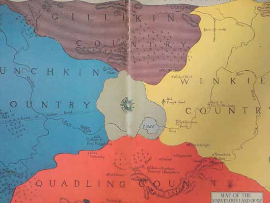
Also notice the proximity and alignment of the Yellow Brick Road and the river in Munchkin Country. The official flag of Oz followed the four-color quadrant design seen above.
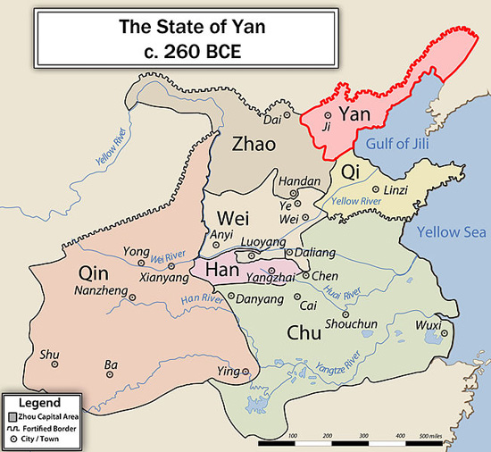
I think this view from Beijing resonates with the formation of China as an empire for the first time. Below is a map from around 260 BC. The City of Ji in the province of Yan (in red) is what would become Beijing. Back in this time, however, one name for which is The Seven Warring States, Yan was one of the weakest states. Qin conquered the other states and its King took the title Shihuangdi, meaning literally the first Emperor of China. The capital of the short-lived Qin dynasty was at Xianyang, which we know today as Xi'an. Its fall led to the rise of the long-lived Han dynasty.